Introduction and setup
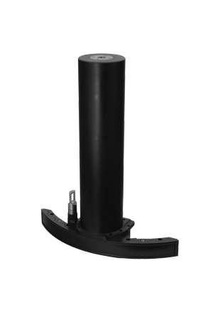
This case study presents the powerful range performance and advanced feature set of the NORBIT WINGHEAD X Midwater. Despite its lower operating frequency compared to shallow water mapping sonars, the WINGHEAD X Midwater is compact and portable, making it suitable for a range of vessel sizes.
NORBIT WINGHEAD X Midwater, combined with Applanix OceanMaster GNSS/INS, features GNSS electronics tightly integrated in the topside unit, an IMU, and integrated INS software tools. The sonar contains an integrated sound speed sensor, and the NORBIT PORTUS mounting pole is offered as an option.
Sonar Equipment used:
NORBIT WINGHEAD X Midwater, combined with Applanix OEM OceanMaster GNSS/INS.
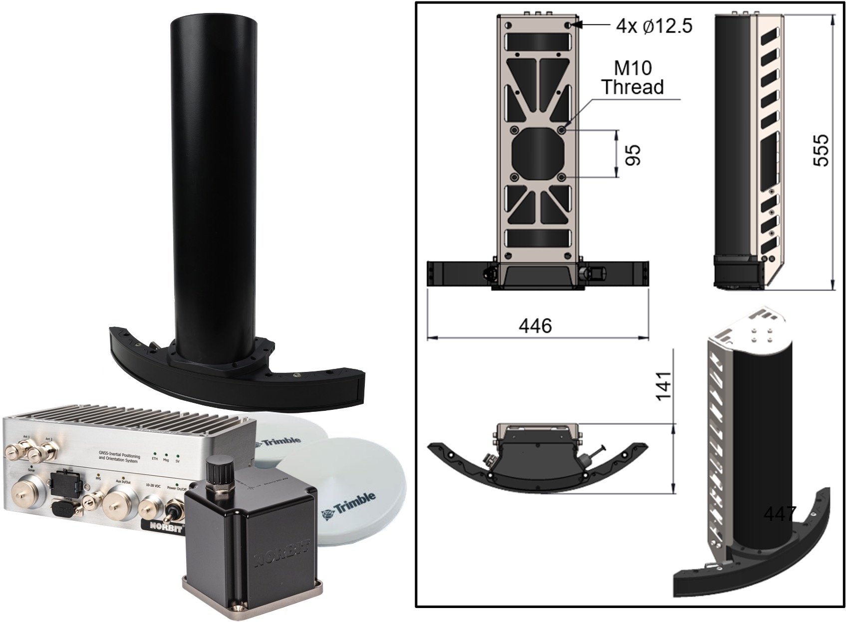
Sonar Product Overview
The WINGHEAD X Midwater is a lightweight multibeam sonar system for mapping shallow to medium water depths, providing high-resolution data over long ranges.
- Frequency agile from 80-240kHz.
- Range performance exceeding 1250m.
- 2.0x2.0° beam widths at 100kHz and 1.0x1.0° at 200kHz.
- 1024 dynamically focused beams per ping.
- Full motion stabilisation (roll, pitch and yaw), ensuring uniform sounding coverage in dynamic sea states.
- Dual Swath generates 2048 beams, offering greater sounding density and reduced survey time.
- Mounting bracket included.
- The system weighs 15.3kg in air (excluding bracket).
Note: A core configuration is provided as standard, with optional features that can be enabled over time
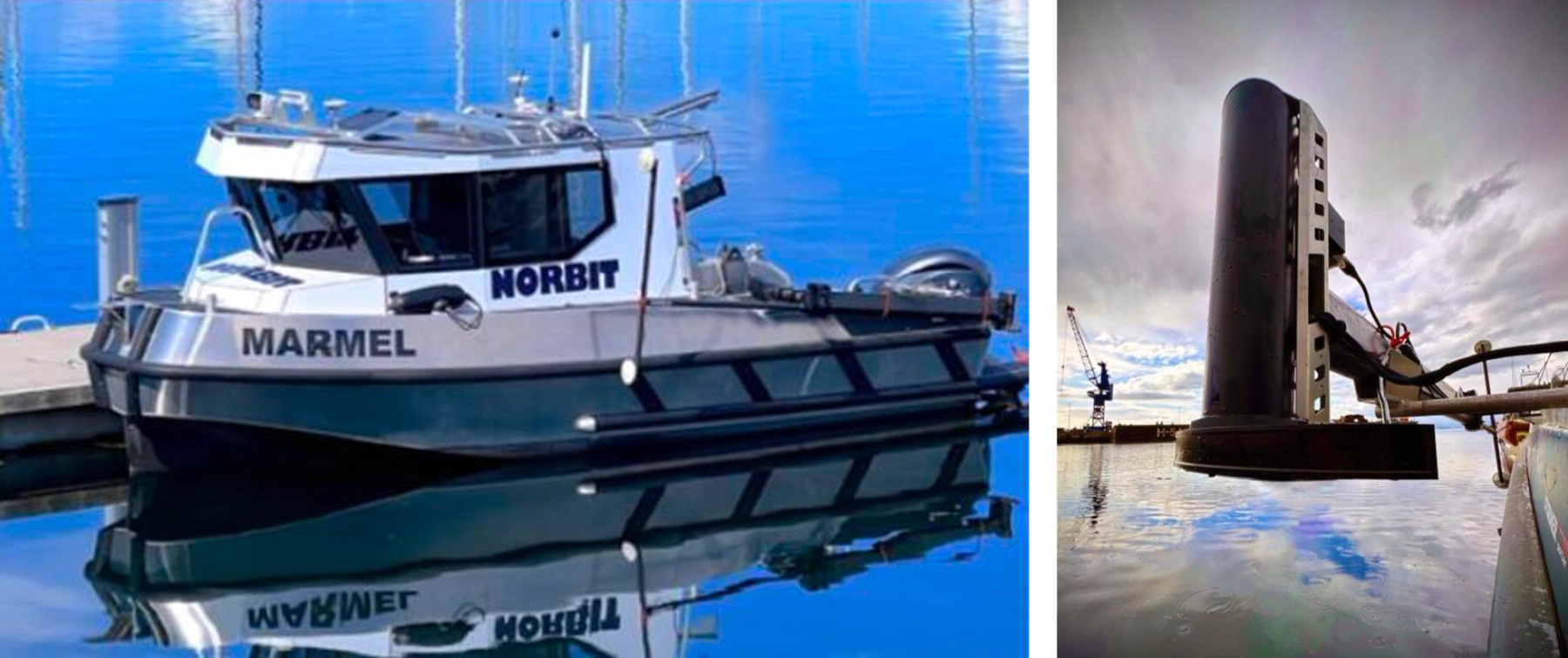
Installation using the Portus Pole
The compact form factor allows the entire system, including the sonar, cable, and topside unit to be transported in a single Pelicase. Unlike traditional lower frequency systems, which typically require multiple cables for the transmitter, receiver and sound speed probe, the WINGHEAD X Midwater uses a single cable for easier deployment.
The system draws very little power (typically <95W) despite its long-range performance capability. Rapid deployment and recovery of the sonar makes it well-suited for temporary installations on small vessels as well as permanent installations on ocean-going vessels.
Results: Range Performance
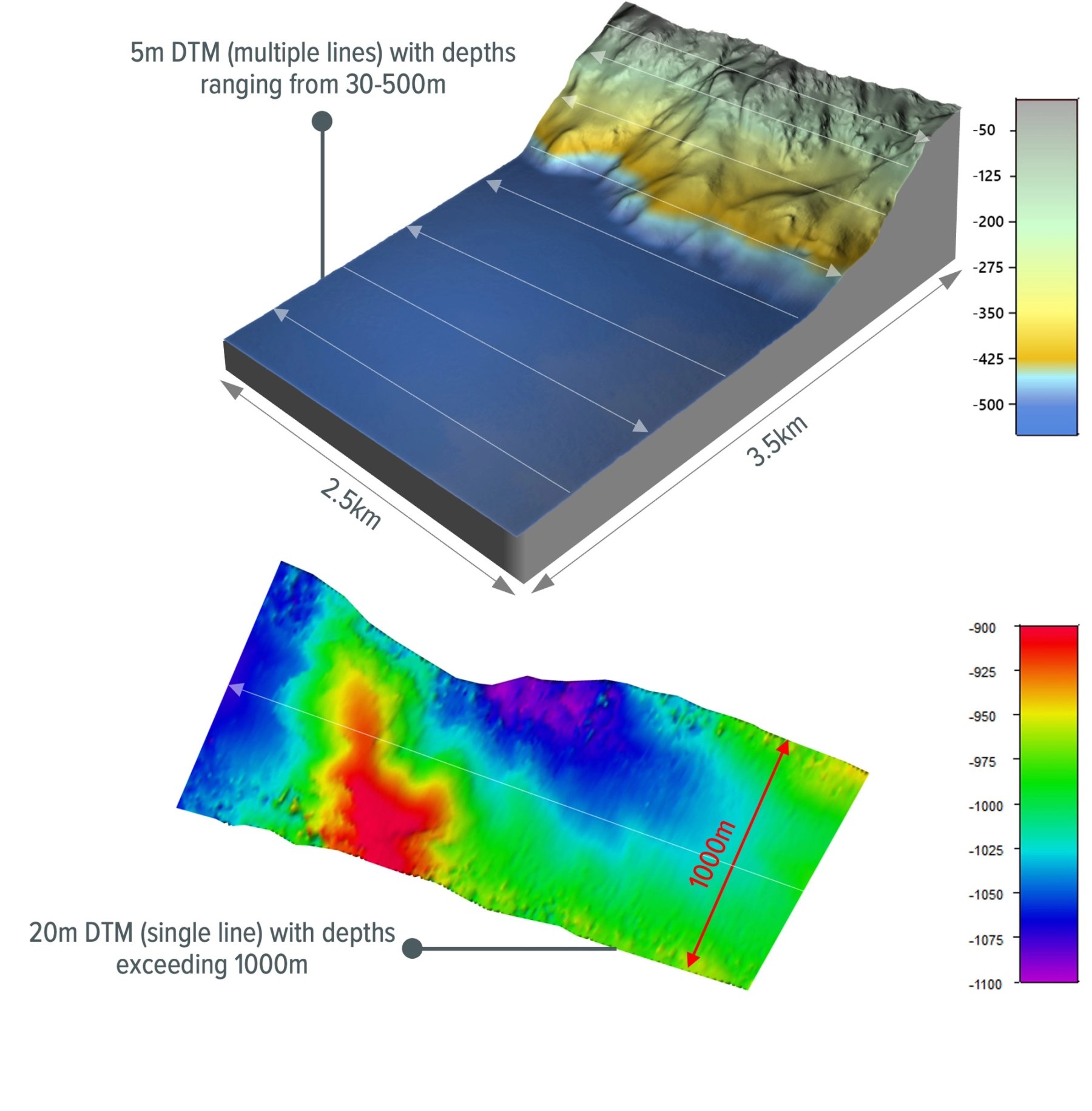
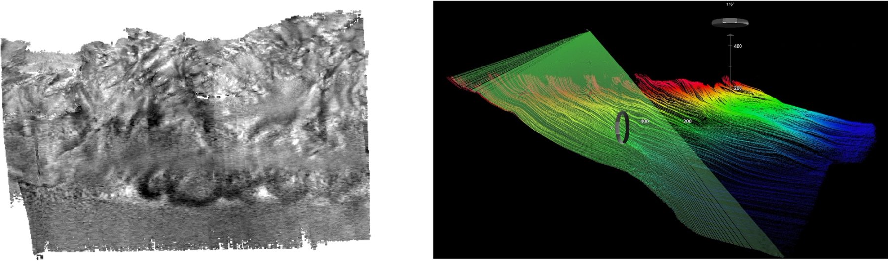
A 7.5km2 area was surveyed with multiple passes in the Trondheim Fjord, Norway, with depths ranging from 30m to 500m. Swath coverage equivalent to 2 x water depth was achieved at 500m depth in a single pass. Frequency modulated (FM) pulses at lower frequencies maximise the achievable swath width by sending more energy into the water, without compromising resolution.
Additional tests performed off the west coast of the USA, in depths exceeding 1000m, achieved 1000m swath coverage, demonstrating consistent high performance in deeper waters.
Results: Resolution
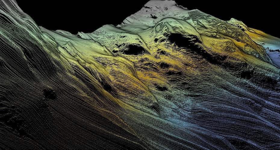
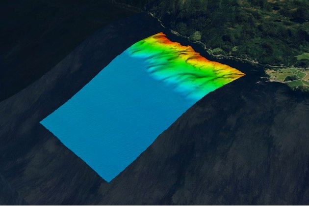
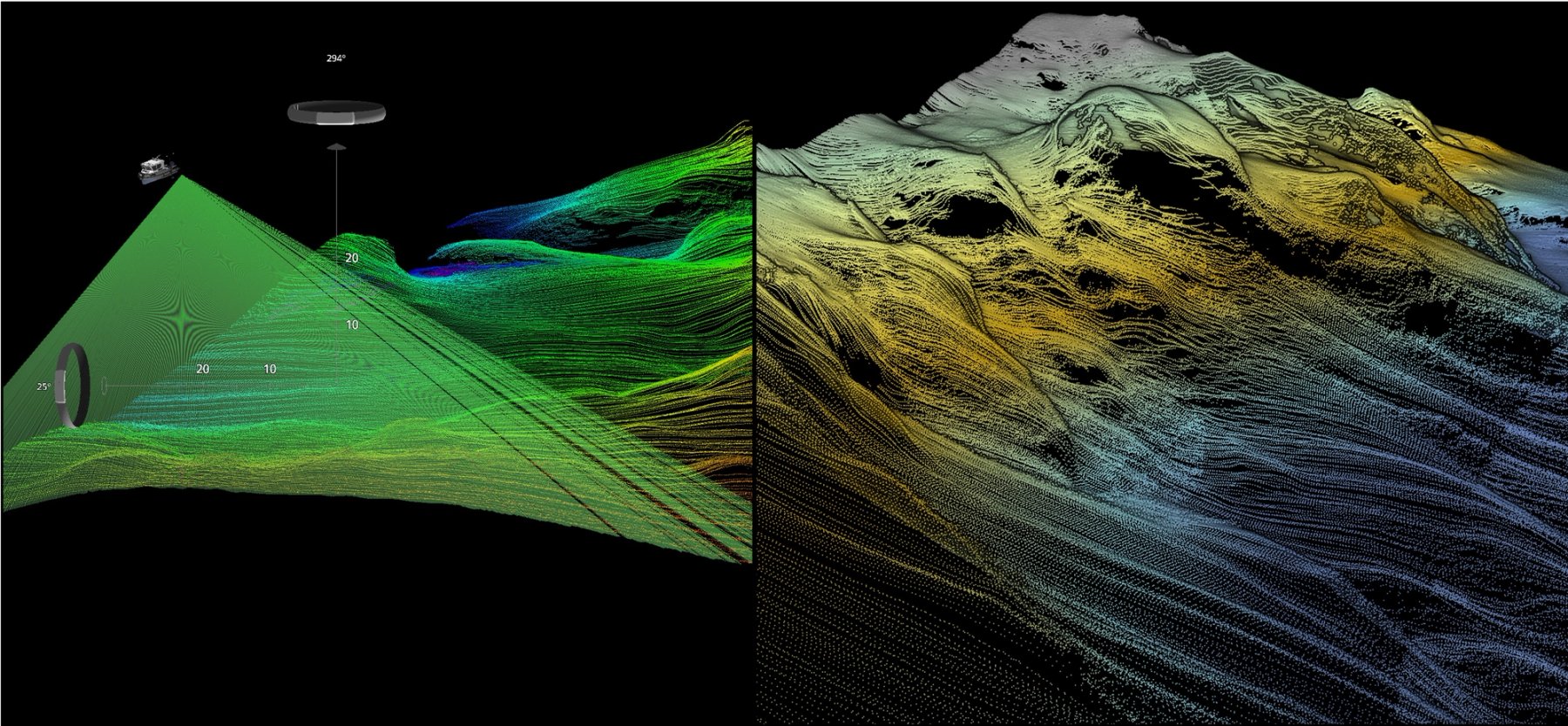
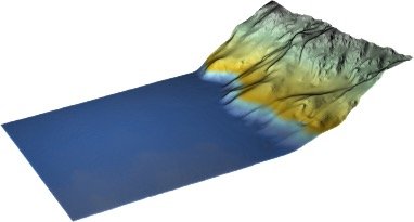
High-resolution point cloud data was collected in the diverse underwater terrain of the fjord, where the depth drops rapidly from 30m to 500m. The data reveals clear features such as small ridges and rock outcrops on the steep slope
Results: Dual Swath
In deeper waters, where longer ranges naturally limit ping rate, the licensed Dual Swath feature upgrade enables multiple ping transmission, generating 2048 beams and doubling the number of soundings to maximise along-track coverage.
Alternatively, it can be used to increase survey speed while maintaining the same density as single swath operating modes.
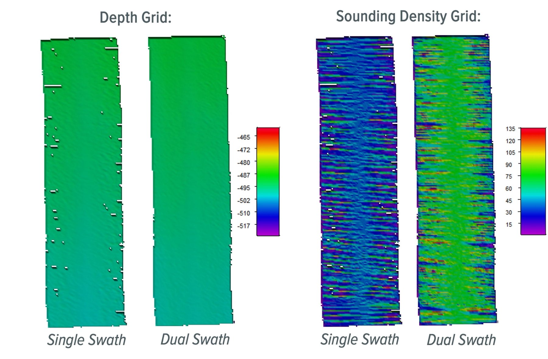
The example shows 2 lines recorded at the same location, with the same vessel speed, in 500m water depth, gridded at 10m resolution.
Dual Swath reduces coverage gaps on the gridded data. The average sounding density is 80 hits per grid cell, compared with 40 hits per cell for single swath.
Results: Yaw Stabilisation
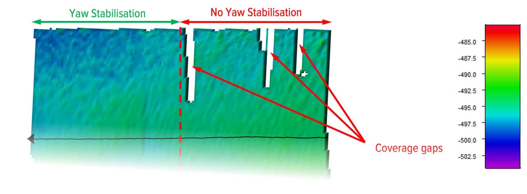
Yaw stabilisation is available as a licensed feature upgrade and compensates for vessel heading changes due to motion and weather, improving sounding distribution in the outer beams.
This prevents gaps in coverage and reduces the need for additional infill, enabling confident use of smaller bin sizes, and more reliable target detection.
The following example shows the gridded outer beam data from the same area surveyed with (left) and without (right) yaw stabilisation.
Key Highlights
- The WINGHEAD X Midwater achieves long-range mapping with a single compact unit, eliminating the need for multiple cables and complex deployments.
- Dual Swath, pitch stabilisation, and yaw stabilisation significantly improve seabed coverage and the reliability of target detection.
- Field-proven performance in multiple locations,
Conclusions
The WINGHEAD X Midwater offers a powerful solution for shallow- to medium-depth multibeam mapping, combining portability, low power consumption, and high-resolution data. Frequency agility and long-range performance (>1250m) make it suitable for both shallow and medium water depth operations.
Despite its powerful capabilities, the system remains lightweight, energy-efficient, and easy to install, requiring only a single cable for the sonar and a small topside unit. It can be operated either as a standalone sonar or combined with an integrated GNSS/INS subsystem provided by NORBIT.
With support for Dual Swath (2048 beams) and full motion stabilisation (roll, pitch and yaw), the WINGHEAD X Midwater ensures high-density, uniform coverage even in challenging sea conditions.
WINGHEAD X Midwater
WINGHEAD X Midwater
Ultra High Resolution 3D Medium Depth, adaptable Bathymetric Sonar System